Respenda De La Peña
- Home → Trails Montaña Palentina → Respenda De La Peña
The Rañas of Valdavia River


Route Description
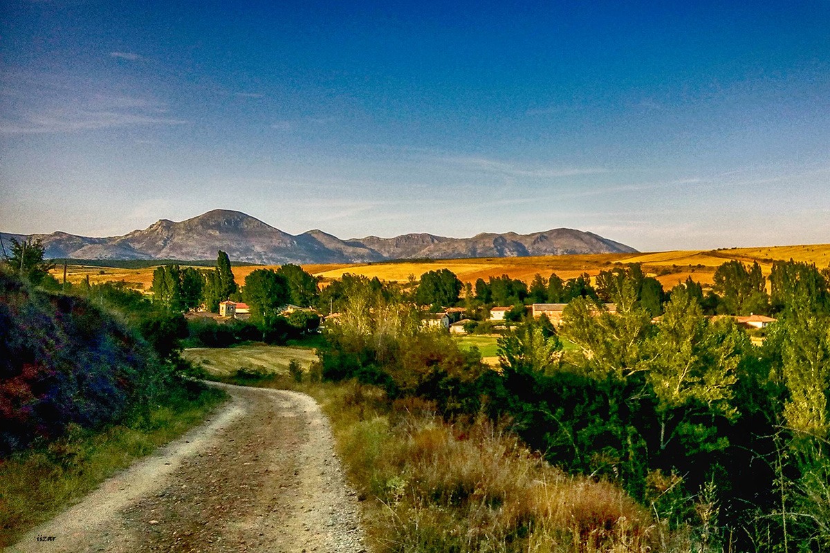
Respenda de la Peña is a municipality located in the province of Palencia, Spain. It is known for its natural beauty and is a popular destination for mountain routes. One of these routes is “Las rañas del río Valdavia” which takes you along the Valdavia River through valleys and elevated areas known as “rañas”.
The Valdavia River originates in the neighboring Sierra del Brezo and flows through deposits, creating valleys with interfluves, which are flat elevated areas between two rivers known as “rañas”. In these elevated areas, a significant portion of the terrain has been affected by the loss of vegetation cover and soil acidification. However, you’ll also find extensive areas covered by rebollo (oak) or reforested wild pine.
The route starts in Respenda de la Peña and follows a winding path alongside the Valdavia River, leading you to Riosmenudos de la Peña. Along the way, you’ll pass the town of Vega de Riacos. After crossing the P-214 road, you’ll head north through the small valley of Arroyo de las Cuevas before ascending a small hill.
Following a quick descent, you’ll reach the vicinity of the village of Barajores, where you’ll ascend the course of the Villafría stream. At the midpoint between Barajores and Villalbeto de la Peña, you’ll cross the stream near some small and picturesque waterfalls. Continuing north, you’ll reach the town of Villalbeto, and from there, you’ll head towards the dam wall of the Villafría reservoir.
Once you’ve conquered the short but steep ascent, you’ll turn west and descend through a grove of oak trees into the Valdavia River valley. After crossing the road, you’ll enter the final stretch of the route, which offers a comfortable walk along the riverbank.
Route Data
Difficulty
Easy
25%Approximate Time
- 2 Hours
Distance
- 20 Km
Elevation Gain
- 325 Meters